Wednesday, February 26, 2014

Arizona here we come

Wednesday February 26, 2014

Destination - Arizona

It was 12ºC and over cast this morning and over cast when we got ready for our trip to Tucson.

We were on I-10 by 8:30am. The drive was interesting, highway was good and the land was flat with low mountains in the distance. The elevation was 4395 ft.

A short time later we were directed through an Inspection Station with a sniffing dog. The Border guide asked if we were US citizens.

This trip had a few themes.

Signage: Dust Storm Warnings - five sightings in NM and AZ
Silver City Art Centre – North of I-10 on 180 NM
Akela Flats with an Exon service station Ex. 102 NM
Butterfield Station (Exon) Ex. 62 near Gaga NM
Continental Drive at mile 49 NM – Elevation of 4572 ft.
The Thing in between Wilcox and Benson AZ

Trucks with Ads


Rail repair with trains waiting

Walnuts, Pecan and Wineries – at Bowie AZ

Cactus, Washes Dry Rivers and Desert.

Texas Canyon AZ – rocks elevation – 4557 ft. East of Benson

We made one pit stop. Arrived in Arizona at 10:45 and stopped for diesel at San Simon AZ 4K Service Station.

When passed through Benson we noticed the many RV Parks. We will have to mark this area for future destination and winter stay as Tombstone just South on AZ-80.

As we neared Tucson we noticed that the trees had leafed out making the view greener. Even the cactus were blooming.

We checked in for one night at Tucson/Lazydays KOA $39.95/night, leaving the truck hooked up.


So until next time remember to "Discover It and Live It".


Tuesday, February 25, 2014

GPS - Do We Need It

Location - Las Cruces, New Mexico Tuesday, February 25, 2014

Have you used a GPS (global positioning system) or do you own one?

Years ago most people used maps to navigate new places that they have never been. Going to a new City or State would require a bit of planning. First you visit your local motor association or local tourist information centre for a maps and guides of the location you intend to travel. Or you can wait and get this information once your there.


The use of GPS technology is more widely spread today. Manufacturers are including them as standard equipment in new car and trucks. There are mobile units that can attach to the dash or wind screen and then remove when parked. Cell phone are now replacing the stand alone GPS for use anywhere. As a result people are carrying less maps in the vehicle. Maps can clutter up the front seat and are never folded correctly and find them on the floor in the back seat. Maps are just inconvenient, cumbersome, and usually wrong anyway.


Four years ago when we first decided to become full-time travelers we purchased a Garmin GPS with lifetime map upgrades. It has worked very well, although sometimes we have disagreements with the polite lady that tells us where to go. She is always “Recalculating” but will eventually get us to our destination.


Misshape Location – We were on a grocery shopping trip to Mountain View Market Co-op in a mall (don't even know the name of the mall) in downtown Las Cruces, NM. We had only been in the store for fifteen to twenty minutes and was surprised to find the GPS was dead.

GPS Problem – No power, battery is dead. Even the 12V power cable is not activating the unit, so the lithium battery must have been over heated on the dash of the truck, but the temp was not that hot today and the GPS had been working to get use to this location.

The immediate problem was to get home (back to the KOA where the trailer is parked) without a GPS. We did not have any maps in the truck. So all we had were our memories of the turns and directions the GPS had use to get us to where we now sit. The compass on the dash is working, so we knew that we must go west to get to the KOA. The KOA was located on Hwy 70 and that ran east and west through Las Cruces, so we had to find that.

Solution – to buy a new GPS and see if the manufacturer of the old one will fix the problem

Action – At home (trailer) I let the GPS unit cool down to see if it worked after a rest. It didn't work. The next day we were to meet friends Jay and Roni for a brunch. Roni was helpful by sending an email with directions to their home. I also found it on Google Maps and Street View. But the printer wasn't working to give us a hard copy to follow. I transcribed the directions by hand. Later that evening I found the printer cable had come loose so now with it I printed a Google Maps version of the directions.


You must be asking yourself “Why don't I use my Android for the directions.” Well we don't use our phone for “Data” in the US, it's too expensive.


The brunch went very well. The restaurant “Sunset Grill” had a great menu. We said goodbye to Roni and Jay who gave us more directions to “Best Buy” just down the road.


Best Buy had sales on a couple of the Garmin models. We purchased the “nuvi 2457 LMT and headed home to set it up. This unit, like the old one connect to the computer and the internet for map updates. With anything boughten that uses data, it should be updated as soon as you get it. Well the update took 12 hours using the free Wifi here at campground.


Now all that was missing were the destination point from three years of collecting (many, many, many of them). The program used to communicate with the GPS has a feature to save all of the user data to a file. I did not use this feature on the old Garmin, so I plugged it in to the USB port to see if I could transfer the destination data with a dead battery. There was nothing right away, but in a minute or two the screen on the dead GPS came to life. What was going on? I thought the lithium battery was kaput. But here it was charging and coming to life. "It's alive! It's alive!" to quote "Young Frankenstein" (1974). In a half hour the unit was running.

So the big question was Why? As it turns out the 12V cable in the truck was not working, I didn't need a new GPS just a new power cable. Go figure. We now have a back-up GPS. That's a good thing.

Well the new unit works just great with lots of new feature and the old destination data transferred in. We even like the sound of the girl that give good direction. We haven't given her a name yet, but she seems to be sophisticated and well educated.


So until next time remember to “Discover It and Live It”.


Gulf Places

February 14 to 16, 2014 - Mississippi

Randal could not resist early morning sunrise pictures of the Old Bay, Lillian AL at Gulf Shores KOA Kampgrounds before leaving for Gulfport, Mississippi on US#90 Gulf Coastline.


When we got on the road the GPS lady directed Randal for an hour drive on secondary county roads, zigging and zagging through the countryside of farms lands, before linking up to US#90 and to I-10. At one point Randal ignored the GPS lady when he saw a sign saying, “To 1-10”, which went nowhere but a detour off a dead end of new construction.

At Mobile AL we drove though a tunnel and across bridges over Mobile Bay. A few minute later we were in Mississippi. A long bridge went over Pascaagoula River, at an elevation of 2 feet.

At 11:00am we drove passed Biloxi to Gulfport when we arrived at Gulf Haven Campground off US#90. This campground was completely destroyed three time by hurricanes. In 1969 by Hurricane Camilla; 2004 by an hurricane. It was washed out again during Hurricane Katrina in 2005 and was rebuilt.
On August 29, 2005, Gulfport was hit by the strong eastern side of Hurricane Katrina. Much of the city was flooded or destroyed in one day by the strong, hurricane-force winds which lasted over 16 hours and a storm surge exceeding 28 feet (9 m) in some sections.

Gulfport was incorporated on July 28, 1898, was founded by two men, on was the president of the Gulf and Ship Island Railraod that connected inland lumber mills to the coast, and the second one who who later took over the G&SIRR, dredged the harbour in Gulfport, and opened the shipping channel to the sea. In 1902, the harbour was completed and the Port of Gulfport became a working seaport that now accounts for millions of dollars in annual sales and tax revenue for the state of Mississippi.


We checked in for three nights at 39.00 at night. While we were there it was sunny with temperatures ranging from 3ºC in the morning to 19ºC by afternoon. We were able to sit outside for our happy hour.


We saw areas that is still not developed since 2005 hurricane. Foundations and parking pads sitting empty. Many 'For Sale' signs lined the streets. All the newer building are built on cement stilts.


Every morning we walked along the Randal and I went for a walk along the white sanded beach. The tide was out leaving sand bars for us to walk on. There are no sea shells here like the beaches on the Florida coasts. In fact the beaches looks dirty near the water. No waves at coming in at low tide. Volley ball nets were set up several parking lots and benches along the side walk.


One afternoon Randal and I went on tours to Long Beach, the next town.


The pier in Gulfport was closed due to damage. Many people were out enjoying the warm weather and the gulls were all over the place. A couple of young people were fishing with nets in the drainage channel for minnows.


Randal was up and out by 6:00am to take sunrise photos. He even captured the full moon.


When I went for my walk I could hear a US Military Band playing the National Anthem. I passed the Waffle House and thought it would be nice to go for breakfast so I returned to the trailer to invite Randal out for a large breakfast. Now we feel stuffed and will not eat until suppertime!!!


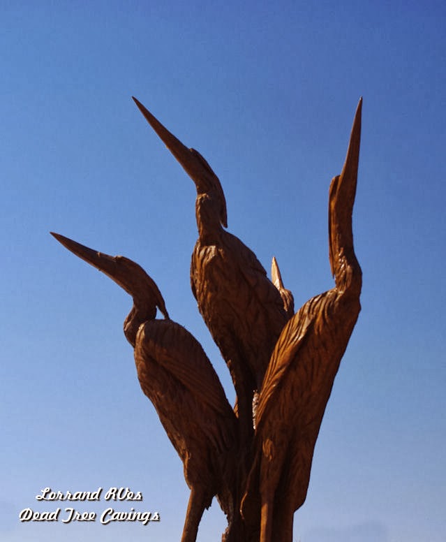
On Sunday we drove into Biloxi. We drove along US#90 on the shoreline and stopped in a parking area to see Katrina Sculpture Garden by Scroggins, a Wood Sculptures Artist. These tree sculptures paid tribute to people who lost their lives during the 2005 Hurricane for the victims

Biloxi's Katrina sculpture project began in January 2007 when Mayor A.J. Holloway and Public Affairs Manager Vincent Creel spoke with Mississippi “chainsaw artist” Dayton Scoggins about sculpting marine-related figures from the dozens of standing dead trees in the median of Beach Boulevard in Biloxi. The trees were victims of the saltwater storm surge of Hurricane Katrina 16 months earlier. In March 2007, after MDOT crews "topped" the dead trees, Scoggins made the first of two sculpting visits to Biloxi, creating egrets, seagulls, pelicans and dolphins from a collection of trees just west of the Biloxi Lighthouse. Scoggins's initial five sculptures -- a $7,000 investment for the city -- inspired Fort Walton Beach, Fla, sculptor and frequent Biloxi visitor Marlin Miller to approach the city about donating his time and talent to sculpting more standing dead trees in the center medians in Biloxi.
Historical sign on the pier explained the WAD IN , a protest gathering during the Civil Rights Movement during the early 1960s where the rights of African Americans demanded the rights to the beach area.

On April 24, 1960, a terrible race riot occurred when 40-50 African-Americans attempted to swim off of the Mississippi Gulf Coast beaches in Biloxi and Gulfport. The whites-only beach became a scene of chaos as angry whites attacked the civil rights activists with sticks, chains, blackjacks, and pool cues. Four were seriously wounded in this incident. The violence continued into the night, and two white men and eight black men suffered gunshot wounds.

We walked to the Lighthouse built in 1847 near the sea wall, endued more than 20 devastating hurricanes the most destructive being in 1893, 1906, Camille in1969, and Katrina in 2005 when it was damaged. We walked out on the East Pier which had been rebuilt since the hurricane. The gulf water is very shallow. As we walked back to the parking lot there was a tour car (Biloxi Tour Train) pulling out and we over heard the lady conducting the tour say that all the sand on the beaches along here was brought in in 1960s. That was an interesting bit of information. We went into the Tourist Information Centre across US#90. There was a statue of Pierre Le Moyne d'Iberville, a Canadian who born in New France near Montreal.


Pierre Le Moyne d'Iberville (16 July 1661 – 9 July 1706) was a soldier, ship captain, explorer, colonial administrator, knight of the order of Saint-Louis, adventurer, privateer, trader, and founder of the French colony of Louisiana of New France.

On entering the Tourist Information Centre we saw it is decorated for Marti Grai. The Building was rebuilt in 2011 after the last on was devastated during Katrina. There was the 24th Annual Mississippi Coast History Week celebrating the 315th Anniversary of d'Iberville's Landing in Mississippi. We talked to an Acadian/Cajun dressed in 1700's costume.


So until next time remember to "Discover It and Live It".


Thursday, February 13, 2014

Lillian, Alabama

Wednesday, February 12
Lillian, Alabama

We were up at 6:00am CT and before we left we walked to take our last picture of the beach.


It rained heavily all night and in the morning there was a thunder storm. So it turned into a Black and White Day. After our morning routine we packed and hocked up in a heavy rain, leaving at by 8:15am CT. Randal was pretty soaked by the time we were ready to pull out.

He did a good job maneuverings out of the site with the trees so closes by. we stopped at the State Park office to get our receipt.


We drove on FL#30 then onto US#98 West a single-coastal highway.


We drove through the many Beach Resorts then the Hyw widened into a double lane road for most of the trip.


Taking this coastal highway prove to be like driving though a very long city, a 170 mile city.


The highway followed the Gulf of Mexico shoreline. Between the highway and the beach was a multitude of resorts, large hotels, amusement parks, businesses and tourist traps.


The elevation was 35 feet most of the way and we had views of the gulf, lakes and inlets. There were several State Parks were in this area as well.


Some of the resorts we passed through were Port St. Joe, Mexico Beach, Panama City, Destin, Fort Walton Beach, Gulf Breeze and Pensacola before we arrived at Lillian, Alabama.


The average speed limit was 45 MPH with many stop lights and a lot of slow traffic. We crossed many long bridges that went over St. Andrew Bay at Panama City, Choctawatchee Bay at Destin, and Pensacola Bay in Pensacola.


At 10:45 ,two hours into our trip Randal pulled over in a turnoff lane to use the biffy, that we hall behind us for just such an occasion.


The temperature did not get higher than 8ºC and it was still raining when we arrived at Gulf Shore KOA in Lillian, Alabama. After a 6 hour drive we decided to book for two nights. For $55.47 us we have a full service, 30 amp, pull through in the mud. Over night the ground did dry so as Canadians say “It's Not Too bad.”


The park is familiar to us as we had been here two years ago. It felt good the get things set up, warm up the trailer, change into some dry cloths and relax for the rest of the evening. Every thing got a lot more colourful the next day.


So remember “Discover It and Live It”.


St Joseph Peninsula State Park

Monday February 10, 2014

Destination - St Joseph Peninsula State Park

Today was our travel day, a four and a half hour - 422 mile trip. It was very rewarding and pleasant. It started with 6ºC and a nice sunrise at 7:15am . We were packed and ready to leave by 9:10am. The temperature rose to 8ºC and the sun was most welcoming.


We took #301 South towards Waldo and Gainesville, turned onto FL #24 linking up to FL#27 West just past I-75. We were now on a single-lane highway. The elevation was 106 feet and there Bayous along the road. We passed over the Suwanee River and pasted through several small towns.

By 10:00am we were getting hungry so I brought out our snacks of muffins, hard-boiled eggs, cooked sausages pieces, sliced cheese, crackers and water.


Some 69 miles later ,at Perry on the Florida Panhandle, we turned onto the Coastal Highway FL#98 West. By this time it was 11:20am and the temperature was now 17ºC. We stopped at a very spacious filling station, Rocky, for diesel.

Along the way we saw light beige soil mounds- mole hills; many old building that was filled with rusty stuff that would be good for ' Antique Pickers' and State Correctional Institutes.

There hay farms, cattle feed lots, goats and chicken barns, and several trucks hauling trees.

We drove through road construction at River Aucilla near St. Mark's National Wildlife Refuge. The road was very near the Panhandle shoreline along the Gulf of Mexico.


We drove over a long bridge over an inlet, through Panacea, Lanark , Carabelle, Eastpoint and Apalachicola.


The homes looked very new and were built on stilts, giving them a high look-out of the Gulf. It was now 1:50pm and the elevation was 20 feet.


In early afternoon we turned onto FL #30A then to Cape San Blas Road into St. Joseph Peninsula State Park. We stopped at the registration office to confirm our site in Shady Pines Campsite for $25.00 night, we booked two nights. It gave us water and electricity, but no WIFI.


The roads into the sites were narrow with tall trees close along each side. Our site had a cement pad and Randal had no problem backing in, narrowly missing one tree.


The map indicated a time zone change from Eastern to Central Time. We were told that there would be a difference as to where we were. It was 2:30pm when we arrived and was anxious to get set up and walk to the beach.

There are sand dunes, which are off limits for walk, but the park has provided wooden walkways to get to the beach. There are 9.5 miles of white sands beaches to walk along.

Camping supplies and food would have to be brought in as the nearest stores and filling stations were an hour drive to Port St. Joe, back on FL#30A and FL#98, West. At the campsite our GPS said the filling station is only 6 mile E. But in reality to drive there on a road is 14 miles South, East and North.

Before we had supper we walked back to the beach for sunset pictures.


The park is full of campers who are very friendly. It is much quieter here and there are no park lights. We will not miss the trains that ran several times during the night in Starke, that effected our sleep.


 The next morning we were up early before sunrise and walked to the picnic and nature trail area to watch the sunrise.


The tide had just gone out and cranes were busy at their breakfast feeding. The sounds of the many birds were filling the air.


So until next time remember to "Discover It and Live It".